
Oldham Weather Forecast: Quiet Weather Returns with Hints of Another Cold Spell (15th–18th January 2026)
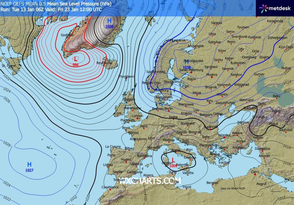
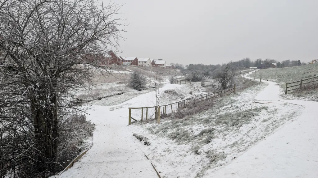
The cold snap at the end of last week is coming to an end with a quieter weather spell ahead in the latest Oldham Weather Forecast, with milder temperatures making a slow return. Many people are already thinking about whether another good winter will be on the way before the end of the month as snow and icy conditions have now subsided in many parts of the area. Forecasts now indicate that some early signs of colder air pushing westwards from Europe are present, although confidence is low and that won’t happen for a while yet. The cold spell of recent times brought snow to higher ground across Greater Manchester, with lower zones getting only fleeting snow cover or none at all. Even though there have been fewer cold spells in the last few years, many people were reminded of what January can offer with frosty mornings and icy roads and wintry showers. With the temperature returning, the focus is now on the longer range, and as usual, weather models are suggesting another outbreak from the east later this month. So far, however, the weather near Atlantic weather systems is still fairly mild. The weather will be unsettled with some showers and a fair amount of cloud at times, but there will be a few brighter spells with less weather to interrupt this week than last. Conditions will feel calmer in the winter, though winds will typically be lighter. The second half of January often has the air of uncertainty, with weather systems battling between the Atlantic air bringing swing to the west, and the colder continental air on the east. It is a reflection of that uncertainty this Oldham Weather Forecast, with no immediate indication of serious winter weather but enough long-range indications to keep snow-watchers keen over the next few weeks.
Oldham Weather Forecast Highlights
|
Day |
Weather |
Maximum |
Minimum |
Wind Gusts |
|---|---|---|---|---|
|
Thursday |
Bright spells after early showers |
7°C |
2°C |
25 mph |
|
Friday |
Sunny spells with early showers |
7°C |
3°C |
20 mph |
|
Saturday |
Mostly cloudy with drizzle |
8°C |
4°C |
20 mph |
|
Sunday |
Cloudy and quiet |
7°C |
3°C |
15 mph |
Thursday Oldham Weather Forecast
Today will start with a few early showers which will move away from the area today, providing brighter conditions in the morning for much of the region. Cloud will gradually increase in the afternoon from the west, so towards the end of the day there will be fewer spells of sunshine. It will be slightly above the recent cold, but still feel cool outdoors, especially where a fresh breeze is felt. Mostly a nice winter’s day Thursday with little rain after morning showers.
Friday Oldham Weather Forecast
Friday is much the same, only with some early showers, a few of which may get wintry over the highest hills before clearing off quickly. After these showers pass, many places will have sunny spells and lighter winds than have been experienced earlier this week. It will be a bit more pleasant in the afternoon as the weather is closer to seasonal norms but with less wind. Overnight lows will be cold, but frosts are not anticipated to be widespread.
Weekend Oldham Weather Overview
No major weather systems are expected to cross the region this weekend, making the weather relatively quiet. Generally light and isolated rainfall will continue over much of the area as sunshine is restricted due to persistent cloud. Mid January will be near normal temperatures with light easterly winds keeping it cool. Overall, this weekend should be quieter than the past few weeks, and so it will be pleasant to be outdoors with the somewhat drab weather.
Saturday
Sunshine will be limited during the day on Saturday with mostly cloudy weather. If there is a lot of cloud, the showers or drizzle may be quite light or isolated, at times, especially in the morning, but there will be long spells of dry weather in many places. There will be a gentle easterly breeze which will ensure the temperature is cool, particularly in exposed areas. With no sunshine, it will be fairly settled with no major weather hazards.
Sunday
Both early and late Sunday will be largely quiet, continuing the same conditions from the weekend. The cloud will persist throughout the day, albeit with some brightening in the evening hours, as it is expected to be persistent overall. There will be generally light winds, and although temperatures are similar to Saturday, there will be no sunlight to add warmth. However, for most areas it will be another quiet but rather flat winter day with a lack of precipitation.
Weekend Oldham Weather Overview
There could be a difference between sheltered parts of Oldham and higher exposed areas that may be picked up during the period forecast. There could be a heavier cloud base and stronger breezes, as well as an increased risk of passing showers, in areas close to the surrounding hills. Lower-down sites may stay drier for longer, especially in the afternoon when there may be some brighter spells. Early mornings will probably give the coldest time of day, and the surfaces will still be damp, with a few spots of mist, adding to the winter feel. Drivers are advised to be extra vigilant when visibility is temporarily reduced, particularly on rural roads and near high ground. However, wet surfaces can be slippery in areas that are shaded even when temperatures are above freezing. Thursday or Friday offer most sunshine, so may be the best days for those with outside plans to take advantage of the afternoon sun.
Cloud, however, may develop rapidly later in the day and so the situation could be significantly different at night-time. A light waterproof cover will still be useful some of the time as there may not be a shower. Conditions are expected to be calmer on the weekend, despite the continuing cloud, due to a lack of strong winds. A few breaks may appear with some sunshine, but this will probably be brief. Likely little additional rain will occur, and current flooding risks are not widespread. However, gardeners, walkers and commuters should be ready for wet weather. Major changes in temperatures are not expected over the weekend. Limited sunshine, combined with cool air, will mean that the overall feel will be rather wintry but daytime temperatures will be close to normal. Temporary breaks in the cloud will allow nights to get colder, but widespread severe frosts are not expected.
Outlook
Weather Forecast: More cloud, isolated brighter spells and showers or patches of drizzle, mainly higher ground, in the near future with forecast for the Oldham Weather Forecast. Atlantic weather systems are likely to weaken as they head towards the UK, bringing drier weather into the middle of next week. The further away from that point, the less certain the forecast becomes, towards developments in northern and eastern Europe. There are still a few long-range weather models indicating a high-pressure ridge may develop over Scandinavia later in the month. Should this occur, there could be a much colder air mass pushed over the UK by easterlies. This would raise frost and icy conditions and possibly the risk of more widespread snowfall. But it is not a foregone conclusion and other forecast models are still betting on milder Atlantic weather instead. The further the game goes, the more likely it seems a battle between Atlantic systems moving in from the west and colder air moving westwards from the mainland. The outcome is still undecided, and residents should watch for further forecasts as the next couple of days unfold.