Oldham Weather Forecast: Temperatures Rising Into the Weekend – Thursday 19th February 2026 – Sunday 22nd February 2026
That block of cold weather is finally starting to ease, but it’s not going away so fast. The past few days have been quite cold and snowy in several places throughout the region, with the higher peaks seeing some snow fields. Although winter has been tapering off, it also never hurts to have an extra wave of winter in mind with its cold snap, frosty mornings, or unexpected blizzard. There is a positive side to this Oldham Weather Forecast, and the decreasing trend will gradually improve on the weekend. A softer flow of Atlantic air will start to turn into the south after the colder spell of Thursday, and this should help to raise highs back into double figures. As with anything, there will be some downsides, but since the weather is rather mild, you will also see some additional clouds, high winds, and the occasional downpour of showers. Yet, the general overall quality of the weather should be much more than what has recently been seen. Sleet or wet snow may fall over higher elevations in the early morning hours Thursday, but this should clear up with increasingly sunny and less cloudy conditions in the afternoon. Friday rolls around, with the mercury rising, and by the weekend, many places are likely to feel more like they’re in early spring than still in the suck of winter. If you want outdoors, don’t miss the combination of mild air and sunny breaks that seems to make it the standout day, Sunday – albeit with a blow of wind.
Oldham Weather at a Glance
|
Day |
Weather |
Max |
Min |
Wind Gusts |
|---|---|---|---|---|
|
Thursday |
Cold with early sleet or rain, brighter later |
5°C |
3°C |
30 mph |
|
Friday |
Rain clearing to sunny spells and showers |
11°C |
7°C |
30 mph |
|
Saturday |
Bright spells with scattered showers |
12°C |
8°C |
35 mph |
|
Sunday |
Mostly dry with sunny intervals and breezy |
11°C |
6°C |
35 mph |
Thursday Weather Forecast
It is cool at the start of Thursday, and if there is any rain, sleet or snow lingering from last night, it will be easing up through the morning. It is good to get dressed appropriately before leaving in the morning, as it is possible for the dampness mixed with the last of the chills could make it chillier than it was on the numbers. While high ground is likely to receive a brief fall of wintry precipitation before the temperature begins to rise during the afternoon, those crossing the tops of the hills, or along more exposed roads, should not assume safety until precipitation ceases. The cooler air will be drawn west, and as this happens, the wind will turn round, indicating much warmer conditions are coming in later in the forecast period. This is one of the most definite early indications that a change in air mass is beginning, and nearly always occurs a little before the temperatures begin to show the improved air mass. Some sunshine may break through in the afternoon, which will be welcome to a fairly grey and cold beginning to the day, though temperatures will remain well below average for this time of year, and that’s combined with the cold wind. If the sky is clear, it’s still possible to feel a bit of a chill breeze swirling around, so anyone outside should still expect to feel the chill even then. With this Oldham Weather Forecast, Thursday is essentially the bridge day between the wintry weather of the past few days and the more general milder pattern likely to start once the weekend begins.
Friday Weather Forecast
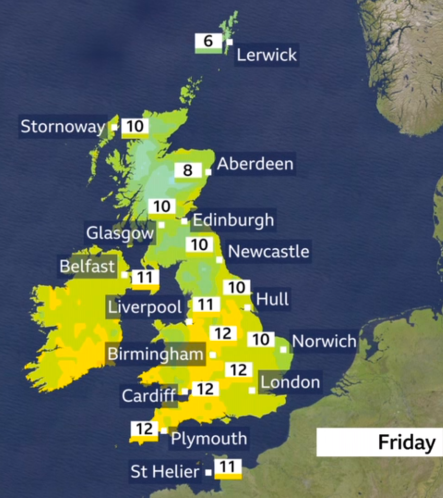
Temperatures are on the rise on Friday, with a sharp contrast to the rest of this week as air from the Atlantic circles the region, and a noticeable difference in how this day will feel compared to the rest of the week. There will be a wet start to the day from a stretch of rain, which should move away to the east relatively quickly, and even if you go to the early band, it is unlikely to linger into the middle of the day. The afternoon then offers a much less uniform and predictable weather scene as a few blustery superficial showers are interspersed with more than a few breaks. Temperatures for many areas will reach double-figure numbers even though there are some fluctuations in temperatures throughout the day, which definitely gives the day a lighter tone than the previous days of the week, and that alone should give the impression that we are in a completely new season! As the temperature rises, the breeze will remain fairly strong from the southwest throughout, and gusty periods will occur at times, mainly in more open spaces of the borough, so a warmer layer may still be required even as temperatures strengthen. But once the sun does appear, it will be nice and warm enough for the end of February, and many will likely be able to feel the change in the wind. If Friday sees planning for outdoor activities for any amount of time, half an eye will still need to be kept on the sky as this Oldham Weather Forecast suggests the days start getting more spring-like.
Weekend Weather Forecast
Saturday
Saturday continues the trend of better weather, but is not assured to be dry throughout the day – and is better than we should assume – so beware of going in with false expectations. The weather will be a mixture of sunshine and showers; the sun may be visible between the showers, and it may rapidly change from hour to hour, so please check the hourly forecast for your unique area. Until recently, the temperature has been cooler than anything we have seen in the past few days, and many of you will be the first, I know, to feel the outdoor temperature just right for a comfortable day – a day in which everything is rubbing along nicely with sunshine in the afternoon, reading alongside the soft southerly breeze. It will be a bit breezy, particularly in open or exposed areas like a hilltop or open, flat space; but a corner that is surrounded by trees should allow for a sense of real lightness this late into February. There is a chance that a quick shower or two might make it a little heavier for a brief period, but then even that quick rain will turn lighter much quicker and there will be plenty of showers that won’t allow any rain to settle for much longer anyway, especially away from any heavier showers that do materialise. Overall, this Oldham weather forecast marks a day of fair weather, but it’s wise to have an extra waterproof coat in case a sudden shower hits out on the day.
Sunday
Then Sunday looks to be the highlight of the forecast period. If you only have one day available to be outside, this is the day you should at least target. A weather front is likely to remain threatening, but will be unable to penetrate to the NW of England, so it should oscillate to the NW of us and leave Oldham and the other areas largely dry with the successful presence of sunny spells and some cloud, which is likely to tumble over the sections at times. With the better conditions, the west breeze will continue fairly brisk all day – it will still be a breezy day even with these improvements – temperatures will be mid-double-figure comfort this day, with better sunshine providing better comfort. There is every chance that a shower or two may occur at any time as the day goes on, particularly later, but the bulk of the day, for most places, is likely to be without rain. If you’ve had the chance to get out in these chilly days, you won’t be able to top this as Sunday has the best prospect of clear skies and less wind, definitely more of an early-springy feel than anything you’ve experienced this week in this Oldham Weather Forecast.
Outlook
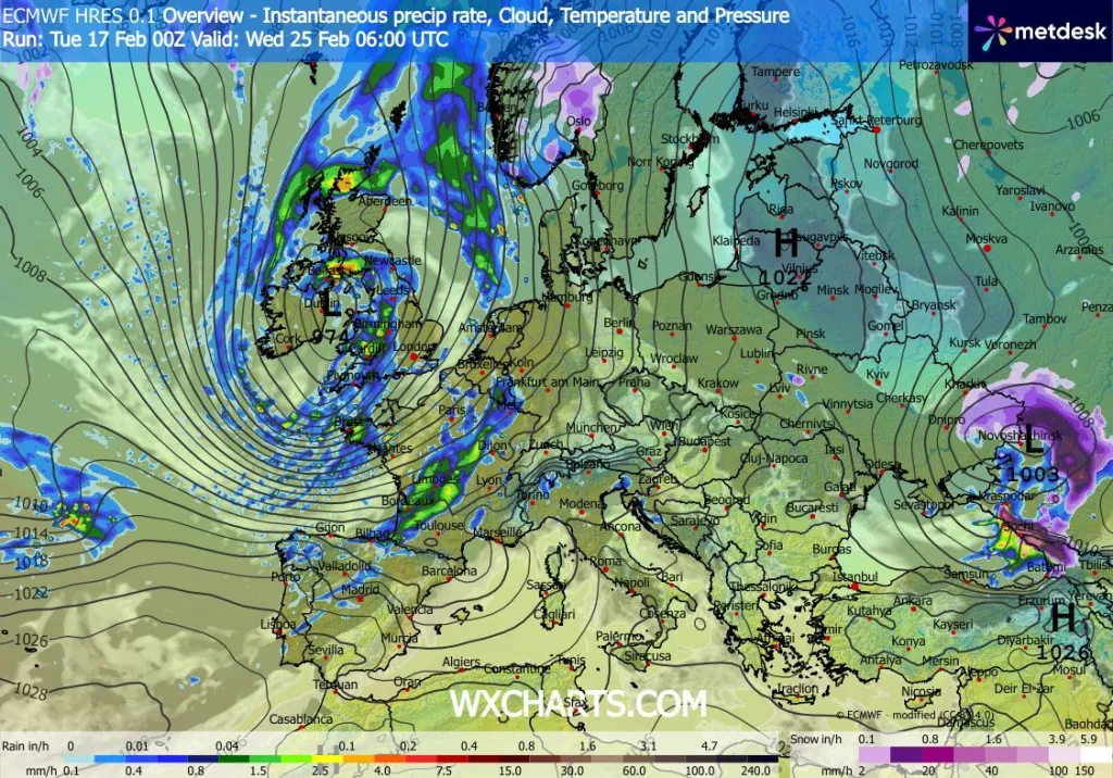
Beyond today and the weekend, the pattern is still being set by the weather systems out in the Atlantic and the Jet Stream and will continue to follow a west-to-east pathway throughout the country. The heaviest and longest spells of rain are likely to be mostly to the northwest in the first part of next week, leaving just a few spells of drier, brighter conditions. Later in the week, models suggest a larger low may move across the country and eventually take a slow turn in the east or southeast direction. This has the potential to bring a couple of wetter days along with a greater chance of stronger winds for a short time. There is some potential at the end of the week for slightly colder air to follow in on these weather systems, but at this stage, there is little evidence of any prolonged period of cold winter weather. Rather, rainfall should be generally modest, along with temperatures staying near normal for the time of year, with brief showers sprinkled in between dry periods. This Oldham Weather Forecast highlights that the good news, however, is that, although the day-to-day forecasts will continue to change, milder air will come back with a single whiff of any brief cooler period. Confidence in the forecast decreases with the distance to the present day, and additional updates this week should help clarify the forecast.