

Oldham Weather Forecast: Atlantic Weather Systems Bring Wind, Rain and Milder Conditions (Thursday 5th February 2026 – Sunday 8th February 2026)
Weather systems from the Atlantic will have a greater influence over the coming days as the conditions continue to be unsettled in this Oldham Weather Forecast, with the ambiguous weather in winter still rolling its dice across the region. The overall weather pattern has finally begun to turn around, although the weather has been dominated by the slow-moving low-pressure systems and abundant persistent cloud cover in the area for several weeks now. The outlook remains unsettled with more rain and high winds to come, but there are some positive notes too – temperatures are slowly rising, and this decreases the likelihood of further inundation of snow and more widespread frost. For the past few weeks, an area of high pressure has been closing off eastern Europe, preventing Atlantic weather systems from flushing freely over the UK. Thanks to this, low pressure has been slowing in nearer to the land, which has been pumping more rain onto parts of the northwest of the country and squally spells of grey skies over the same areas, too. The same configuration has also allowed colder easterly currents to surge here and there, resulting in some snow and sleet in higher elevations in places.
This blocking pattern that’s been holding reign for a while, however, is now beginning to wane and free up the Atlantic to control our weather. They should now progress more consistently to the east, instead of becoming lodged in and stalling across the country. Conditions are not becoming more settled overall, but the pattern is becoming more westerly / southwesterly in nature, and this should bring in less severe air as the week progresses. Although this forecast does not indicate that there will be many days of sunshine, it does mean there is a diminishing risk from potentially severe cold weather. Frosty mornings will decrease, and a few snowfalls will remain mostly on the tops of high hills where temperatures will be mostly close to or slightly above normal for this time of year. A weather forecast can be a lifesaver for anyone who has to travel to work, make outdoor plans, or simply likes to stay updated on the weather for the upcoming days. Anyone who needs to commute to work, make plans for the outdoors, or just enjoys knowing what to expect from the weather over the coming days should find this Oldham Weather Forecast to be a lifesaver.
Oldham Weather Forecast Highlights
|
Day |
Weather |
Maximum |
Minimum |
Wind Gusts |
|---|---|---|---|---|
|
Thursday |
Cloudy, windy with showers |
5°C |
2°C |
40 mph |
|
Friday |
Cloudy with patchy rain |
7°C |
4°C |
30 mph |
|
Saturday |
Mostly cloudy with showers |
8°C |
5°C |
20 mph |
|
Sunday |
Bright spells and scattered showers |
9°C |
5°C |
20 mph |
Thursday Oldham Weather Forecast
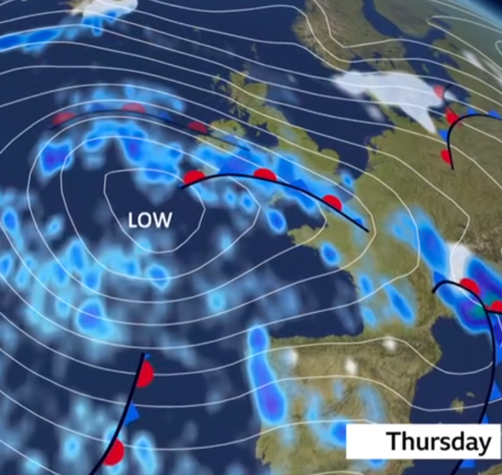
A further unsettled day for Thursday when the conditions are once again heavily influenced by conditions in the Atlantic. You can look forward to a fair amount of cloud in the sky for much of the day, and a strong northerly breeze that will make it feel rather cooler than the temperature on the thermometer doesn’t imply. Showers are likely to be numerous, and heavier than usual on the heavier side as the afternoon progresses. Lifting across the top of the upland areas, including the Pennines, these may briefly turn wintry with short spells of sleet or wet snow before returning to the rain of the lower levels. The highlights of Thursday’s weather will actually be the breezy conditions. Gusts will be expected to be around 40 mph in more exposed locations, and this will create a feel of ‘raw’ and discomfort outdoors. The general amount of rain is not likely to be too much, but with the high cloud cover, strong winds and even a few downpours looked set to make it feel like a cold snap right across the region. It is important to be covered up and prepared for the weather for those travelling out, or spending time outdoors, as it can be unpredictable and sudden.
Friday Oldham Weather Forecast
Friday will be more or less the same as the previous day but a little warmer with the start of some milder North West air. Mostly cloudy may remain through the day, with a few outbreaks of light or patchy rain from time to time expected. This rain will be a bit less heavy, plus some wind relief, but still brisk when outside, than what you saw on Thursday. Despite the cloud hanging around for much of the day, there is a chance of some brighter spells breaking through later in the afternoon, as the showers become more scattered and spaced out. The wind direction is going to slowly turn towards the west-southwest, which will lift temperatures into the upper single digits, doing just that as we head towards the weekend. Overall, it should be a little more comfortable, though no wonder sunshine will be sparse.
Weekend Overview
The weekend should become a little drier and less windy, with a step up over the windy, wet week conditions. It will also be cloudy at times, but there is more positive Atlantic airflow, which will help temperatures to continue to rise, though of course the cloudy weather will dominate the picture in northwest England. For anyone who prefers a little drier weather, Saturday may prove to be the game day as another weather system rolls in later on the weekend. By the time Sunday comes around, brighter spells will begin to be seen in between the small showers, and it will still be a bit changeable around the day. As a whole, it is a more pleasant weekend ahead with temperatures beginning to warm up significantly from the recent cold levels and some enhanced sunshine in between.
Saturday
Saturday will be mostly cloudy during the morning and then some isolated scattered showers that will drift across the area. Although the sky will appear somewhat grey, temperatures are expected to continue to pick up as a bit warmer Atlantic air gets in place over the area. A cool easterly breeze will help to make things fresh, especially in more exposed areas, but not so cool or cold as days gone by. A reasonable chance of some brighter periods breaking through the cloud cover in the afternoon; these should bring a few spells for anyone out and about. It may even fall a few times, but much of the rest of Saturday is likely to remain dry, making it a pretty average day to be outdoors for extended periods on Saturday before more unsettled weather returns later.
Sunday
It looks like Sunday will be the sunniest of the two weekend days. Ensuring skies will clear gradually as the day goes on, with some sunny interludes in each of Oldham and the surrounding area, the morning is likely to be somewhat overcast. A few scattered showers will still continue in the afternoon, but these will not be too continuous. Temperatures will keep going gradually higher, and will reach around 9°C, making it the mildest day for the entire forecast period. The wind should be a good bit lighter than it was earlier in the week, too, making it easier to enjoy this summer weather even if the storm showers are still getting through. Overall, Sunday looks to be a fine mix of warm weather with a good amount of sunshine and typically unsettled weather to start another crazy week.
Outlook
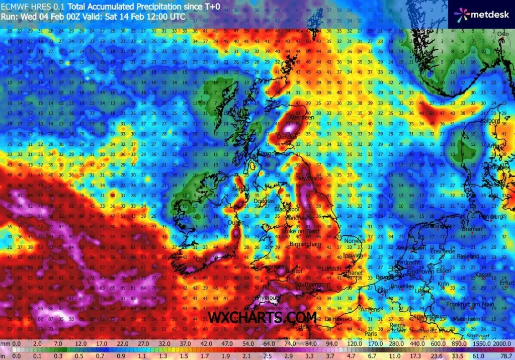
Here’s further out the window, this Oldham Weather Forecast has the Atlantic firmly in the driving seat for the rest of next week. Low systems will continue to track west to east, bringing more rain, with some punctuated by strong winds, arising between the dry periods. The direction that these systems need to travel in is faster than what we’ve seen over the last few weeks, so in that way it will help to reduce the possibility of prolonged heavy rain across the country. Hopefully, the good news is that for now, no strong indications that another big cold snap is in sight. Overnight frosts will be falling and start to occur in decreasing numbers, whilst the snow should remain largely restricted to the highest summits, ahead of lighter southwesterly winds increasing in overnight strength. Expect mostly seasonal temperatures – approximately the same temperature – and will have an early taste of spring for many places, as compared with the colder and more difficult January. Still some sunshine may be scarce at times, but brighter days should come in between the weather fronts as the passing weather. Overall, the week is rather unsettled and fairly normal for the start of February, with changeable weather patterns consisting of cloud, rain, breezy periods and dry at times through the week.
Weather Tips
| Tip | Advice |
|---|---|
| Carry Waterproofs | Showers and periods of rain are likely throughout the forecast period. |
| Prepare for Strong Winds | Thursday will be especially windy, with gusts reaching around 40 mph. |
| Drive Carefully | Wet roads and strong crosswinds may make travelling more difficult, particularly on exposed routes. |
| Dress in Layers | Although temperatures will gradually rise, chilly winds will still make it feel cool outdoors. |
| Watch for Brighter Spells | Sunday offers the best chance to enjoy some sunshine before another unsettled week begins. |